
Río Blanco (Cerro Castillo)
Kurt Casey
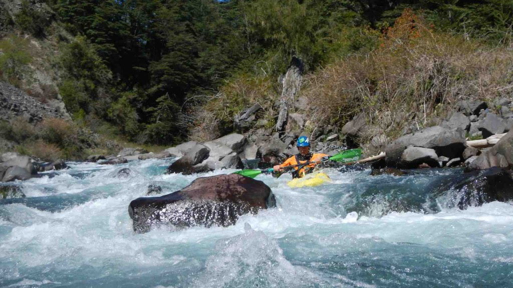
The Río Blanco cuts through canyons of geology run amok in the northeastern sector of Reserva Nacional Cerro Castillo. The most prominent peak in the park, Cerro Castillo (2675 m), was so named because its craggy ridges and basalt turrets resemble a medieval castle. For the geology enthusiast, the river corridor offers a cornucopia of beautiful, short canyons consisting of polished salt-and-pepper granite, dark columnar basalt, pearly limestone, and russet-stained shales, mudstones and sandstones.
Upon entry into the first canyon, we portaged a undercut 5 m-high entry waterfall. At high flows, do not paddle blindly into this limestone gorge prior to scouting. Climb up and over a steep hill on the right for a look. At low flows it is possible to catch an eddy just above the lip of the waterfall. In the next canyon, a magnificent waterfall cascades over vertical granite into the river from the left. Below here the river flows through numerous other short class III-IV gorges of alternating sedimentary rocks and granite. Interspersed between the canyons are nondescript, class III boulder garden rapids.
Run the Blanco at high water in November for some potentially great whitewater action. Clay Wright, Josh Lowry, and I had a scratchy but runnable flow of 500 cfs at the take-out on our mid-December 1994 first descent. The whitewater would be much more exciting at higher flows, especially where tilted ramps of limestone and granite form wild, continuous, slidin’ slabs. The lengthy shuttle and windy, flatwater finale make for a long day, so get an early start. A number of great campsites provide the opportunity to linger overnight in one of the canyons.
From the frontier town of El Blanco, approximately 30 km south of Coihaique, continue south following the signs to Cochrane. Along the way, Cerro Castillo comes into view to the north. Excellent camping abounds in the Nothofagus forest adjacent to Laguna Chiguay. Put in where the road makes an abrupt turn to the south at the confluence of Estero Chico Blanco and Estero Los Mallines elevation 770 meters. If Estero Blanco Chico is high enough, put in 4 km upstream along the road below the lethal culverts. Take out 26 km downstream at Puente El Blanco, 500 m west of El Blanco at elevation 425 meters..
This 26 km class IV run is best done in spring months with flows in 500-800 CFS range. Average gradient is 13 mpk or 70 FPM. There is usually one portage.
Some other nearby rivers include Pollux, Simpson, and Ibañez,
Topo map titled Balmaceda