Rio Blanco de Calbuco

Kurt Casey
-
- A low volume gem flowing of southwestern flank of volcan Calbuco (Mapuche word meaning blue water¨) Located in Chile´s 10th Region de Los Lagos and within the confines of La Reserva Nacional Llanquihue and just above Lago Chapo.

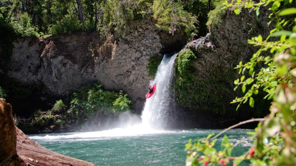
Clay Wright first descent of Rio Blanco
On our first descent January 25th, 2012 Clay Wright and I were pleasantly surprised to find a group of Canyoneers. A Puerto Varas company called Pachamagua does organized tours in the spring and summer months. www.pachamagua.com
We ran many of the drops together and they were nice and enough to let Clay toss his boat and rapel of the final 30 meter drop.

To arrive go east from Puerto Montt on the paved road towards the Puelche Ferry (over Seno de Reloncavi). Just before the Puente Chamiza turn left and travel north to small town of Correntoso. En route the road turns from pavement to gravel. In Correntoso turn left towards Lago Chapo and floow signs to Rio Blanco. It is 5.2 km to a parking area by a pisicultura. From here shoulder your boat and follow a nice boardwalk trail through a Tepa, Alerce and Cipress forest. After 10 minutes you come to a fork in the trail. The left fork goes to base of 30 meter falls and the right climbs up a series of steps to the national park entrance. From the guardaparque entrance continue walking another 10-15 minutes until you cross a bridge over the river. Once on the other side climb up a steep sloping slab where you will reach the top of the first 5-stage series of falls.
This river is a fun option for those taking the carretera Austral route to the Futaleufu River…

Do not be concerned if the river looks ridiculously low. It takes almost no water to run these drops and if I had to guess would say 5-10 CFS. Work your way down 1-2 km to the lip of the 30 meter falls . Here is the takeout but perhaps at higher flows this stout drop is runnable. The falls are bolted with anchors so rapping off is an option but it is also easy to simply walk back down the steps.


Summertime View of Calbuco Volcano below the takeout


Jumping off a portion of the 30 meter drop
Other nearby rivers include Petrohue, Negro, Blanco de Hornopiren, Bonito and Coihueco
GPS coordinates 41.388 degrees south latitude and 72.644 degrees longitude
IGM 1:50,000 topo map is titled Correntoso


