
Rio Chillan

Kurt Casey
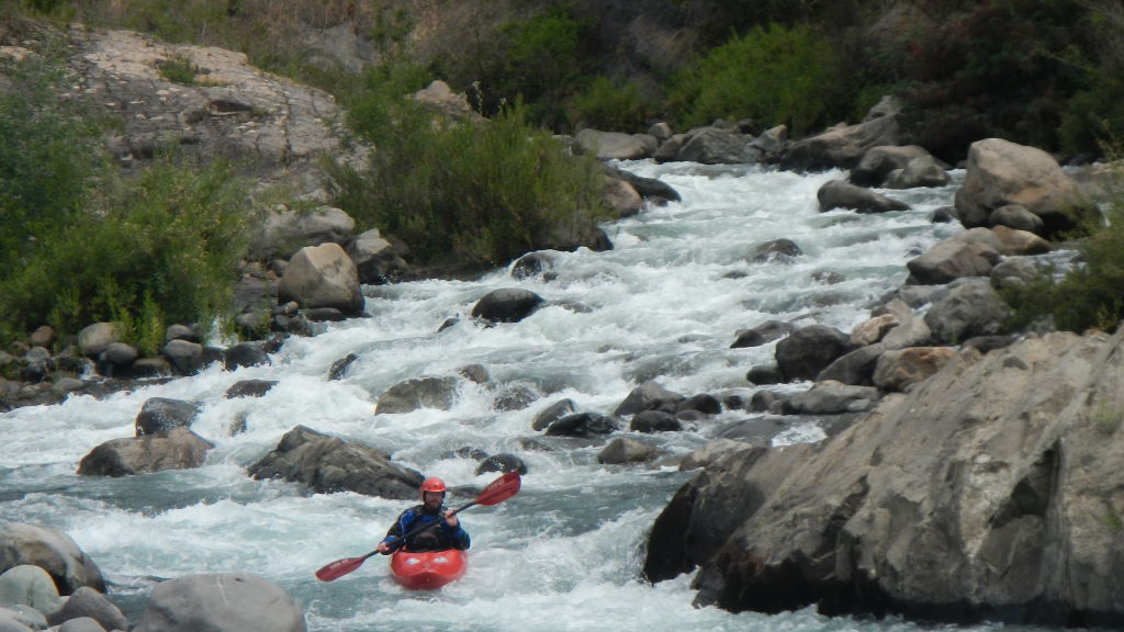
The crystal clear water flowing of the Western Flank of the Nevados de Chillan Volcano (3212 Meters above sea level)are perfectly matched with basalt sluiceways, making for fun class 3-4 kayak run. The Rio Chillan is a winter and early spring run in Chile´s 8th Region. We ran the river in late October with around 300 CFS, which was a good level. Keep you eyes open as Andean condors are likely to be soaring over the columnar basalt walls.
To arrive at the river follow the paved road east out of Chillan towards the Termas de Chillan. Pass through town of Pinto and at KM post 36 go right on gravel road following sign to Los Pellines
From this turn off it is 9 KM to a nice camp along the river, which can also serve as one of many put-ins or take outs for the lower run. At 12.3KM you come to Puente Mañiguales which is probably the best put in for lower part of river. Continuing upstream one reaches Fundo Los Ciegos at KM 14.2. Park here and walk 100 meters to see the as of yet, still un-run, 35 meter Salto Pellines.

Salto De Pellines
Upstream at KM 15.2 is a gate in front of a bridge over the river. Once across the river Fundo Los Pellines is to the left and Fundo El Plan to the right (upstream). The gate is likely to be locked so be prepared to walk from this point. If you are lucky and gate is open cross the bridge and continue following road upstream for another 4 KM (or more if one is willing to keep walking) To find the bridge with Google Earth use GPS coordinates 36.826707° South Latitude and 71.615750° Longitude

Jake Greenbaum headcam shot Rio Chillan
This 5 KM upper stretch is likely to have 300 CFS in early spring (Sept-October) and be too small from November to July. Average gradient is roughly 30 m/km or 150 FPM. It is highly recommended to scout the falls before running the river. A very enticing 100 meter long slot canyon leads to the lip of the falls.. If you find your way into the slot canyon you will be doing a first D of the falls assuming you make it past the decapitation flake at the lip.

Typical action Rio Chillan
The falls are a logical takeout with easy access to the road 100 meters away. Portaging the falls is possible (best of river right) but looks like a real bitch over loose talus. A more wide open river is available below the falls and can be run for an additional 13 km to a downstream bridge at 450 meters elevation.
Short video clip of river by Jake Greenbaum
The IGM Topo map is titled Recinto F-111
Other nearby rivers include Diguillin, Renegado, Ñiblinto, Cato and Ñuble