Rio Laja

Kurt Casey
The run is 4km long with average gradient of 165 FPM. Put in is at 1100 meters at Salto Las Chilcas and takeout is at the ENDESA reservoir 975 meters. Class 4 +/5- run best in spring and summer.
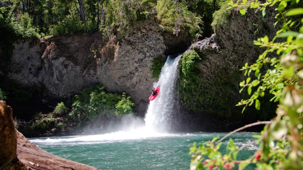
The Río Laja rips through a geologic wonderland upstream from Salto del Laja, a popular roadside attraction off the Pan-American Highway. Draining Laguna de la Laja, this scintillating gem features kick-ass, heart-thumping action from start to finish. The first 200 m are the toughest and should be scouted. Only run the Laja if you have a bombproof roll. In fact, don’t even think about tippng over. Regardless of the Laja’s significance (‘smooth rock’), its razor-sharp basalt will shred you and your equipment if you find yourself upside down. Walking along the shore is impossible due to the vegetation and channels of swift water.

John Foss on the Laja circa 1992
Sierra Velluda (3585 m) and Volcán Antuco (2979 m) (Mapuche for ‘sun’ and ‘water’) grace the southern horizon. In 1873, viscious lava flows from an eruption on Antuco oozed over the valley floor, plugged the river, and caused the water level in Laguna de la Laja to rise 20 m. Cold, clear, groundwater percolates through this porous basalt, bursting out of the canyon walls at Salto Las Chilcas, the nacimiento, or birthplace of the river.
From Los Angeles, 518 km south of Santiago, drive east towards the town of Antuco and Parque Nacional Laguna del Laja. Oncoming cars used to challenge us in a game of “chicken”, waiting until the last moment to swerve off the only paved lane into billowy clouds of dust. That thrill is gone now that both lanes are paved to Antuco. After entering the park, drive 4 km up the hill to an obscure photo-op sign and an eroded concrete foundation. Turn left and continue 300 m to the trailhead. Hike down 20 minutes towards the gushing cascade of Salto Las Chilcas, and the switchbacks that lead to the water’s edge. Take out in the meadow next to the ENDESA reservoir.
Below the reservoir, the river looks steep, but far from deep. In fact, it’s as dry as a sun-bleached bone in the summer. Why doesn’t ENDESA maintain a minimum year-round stream flow for fisheries and recreation?
Topo of map of region is titled Laguna de Laja G-021
Nearby Rivers include the Nuble, Queuco andCautin. forgot about running the Duqueco as I have heard that the whitewater section has been dammed.

